Friday, October 30, 2009

California :: Piedras Blancas Elephant Seals

Near San Simeon, on the Coast Highway, is a special beach. One where the Elephant Seals come ashore for a few months of each year to give birth, breed, and molt. The female and juvenile elephant seals were on the beach beginning the molting process.


More information on Elephant Seals.

Saturday, October 24, 2009

Phend-Fisher Family Reunion Ledger - 1911 & 1912

The 3rd reunion of the Phend - Fisher families met at Frank Wehrleys on June 24 - 1911
The A. M. was spent in a social way.
At noon a basket dinner was served under a tent, on the lawn.
There were about 45 present.
In the afternoon songs were sung and a prayer rendered by Rev. Spangler of the Evengelical church at Elkhart.
A talk by Wm Phend.
Other songs.
Remarks by Rev. Spangler then a storm prevented further pleasures.
It was decided to meet at Jacob Phends near Elkhart on June 29 - 1912.
Adjournment.
Mrs. F. A. Wehrly, Secretary.= + = + = + = + = + =
There is no record of a family gathering in 1912.
= + = + = + = + = + = The Phend-Fisher families gathered for a reunion in Elkhart County, Indiana almost annually from 1909 until 1943. Usually held at Nappanee, the events of the day were recorded in an old ledger book, now in my possession. Sadly, the fragile pages have turned brown, separated from the binding, and are, in effect, disintegrating. Some years more information was recorded than in others, but, for me, these pages provide a glimpse into the past. Spelling has been retained as it was in the original though some punctuation and paragraph breaks have been added. To view all articles in this series click on the "Phend-Fisher Reunion Ledger" label at the bottom of this post.

Friday, October 23, 2009

Just Taking it Easy...

It has been a week since my return. My timing was terrible (that's not exactly the word that went through my mind, but this is a “family friendly” blog). Somehow I had forgotten that it was Labor Day weekend, in both the U.S. and Canada (though there it was Labour Day). And I probably should also have looked a little closer at the map for a different port of entry... getting onto I-5 after crossing into the States was not a good decision on my part.

After I left Hope on Friday morning (September 3rd) there was a considerable amount of traffic on Highway One – it did, after all, go to Vancouver. It may see strange, but I was totally unprepared, psychologically, for all of the businesses and the stores and the amount of traffic on Interstate Five! It wasn't exactly culture-shock, more like sensory overload. Too much all at once. It didn't take long before my nerves were shot!

Almost on the verge of Panic, I exited onto the first highway I saw that would take me away from there – Washington State Road 20. I got through the heaviest traffic area and on past Sedro Woolley. The first State Park that I came to had a “Campground Full” sign, the second park was closed, the third one didn't have a campground. Not good. Then I got to the little town of Rockport. And they have a Municipal Park with a beautiful campground along the river. All of the RV sites were taken but there were still a few tent sites available. Lucky me! It was early afternoon but I stopped for the night anyway. No telling what, if anything, would be available on down the road. It took a while for my nerves to get settled. A nice hot shower helped immensely as did sitting down by the river and watching the water flow by.

Saturday morning, looking at the map, I realized that if I continued east on State Route 20, I'd be going through the Cascade Mountain Range and through the middle of North Cascades National Park. Neither of which would be bad, by any means, but I needed internet access and/or a cell phone signal. So it was back towards Sedro Woolley.

With my errands completed, and because the clouds had blocked out the sun, I decided to go south a short ways on I-5 to Everett and pick up U.S. Route 2, which is a scenic highway through the southern Cascades and Wenatchee Mountains. When I got over Thompson Pass, the clouds disappeared and I saw sunshine and blue skies once again. It was a beautiful drive though I took no pictures to prove it! The landscape changed as I drove east on the other side of the mountains. Fewer trees, brown hillsides, open vistas.

Near Wenatchee U.S. 2 joins up with U.S. 97 and turns north, following the Columbia River, so I did too. Highways run along both sides of the river, I stayed on the west side on the “alternate” route and stopped at the small town of Entiat where there was a municipal park and campground alongside the river. It was almost perfect. Large trees shaded the campground and dotted the riverside. Two nights I spent there, soaking up the sunshine and basking in the warm temperatures (low 70s) and light breeze, generally just taking it easy.

The view from my campsite, looking northeast.
Looking southeast.
From the north side of the park, looking toward the west. The campground was nestled amongst the trees on the western shore.

Thursday, October 22, 2009

Clay Jug


This is probably my favorite of all the photos I took on mine and my friends trip to Old Town. It was sitting in a back corner of an outdoor coffee shop area.

Wednesday, October 21, 2009

Bicycles, Walls and the Passage of Time


Over the holidays I received a DVD of a film diptych that I'd long wanted to watch: Cycling the Frame and The Invisible Frame, directed by Cynthia Beatt.


In 1988, Beatt made the short filmCycling the Frame. Described as a "cine-poem," this 30 minute documentary follows a young British actress (Tilda Swinton) as she cycles along the perimeter of the Berlin Wall in what was then West Berlin. It is a 100 mile journey along mostly abandoned roads and overgrown dirt paths crossing forests and fields. The ever-present wall, with its menacing guard towers, turns the landscape surreal: It severs railroad tracks, creates paths to nowhere, and separates waterfront properties from the bodies of water they front. As Swinton pedals, she vocalises her stream-of-conscience thoughts about the things she sees and how they make her feel. As she grows tired of cycling and overwhelmed with her surroundings, the film begins to resemble a dream sequence. Finally she arrives to her Brandenburg Gate start and concludes that "this place is mad."


More than two decades after the original journey, the director and actress set out again to film the follow up, The Invisible Frame. In , they retrace their route along the now long-absent Berlin Wall. A visibly more mature, sharper dressed Tilda Swinton cycles the perimeter, this time weaving back and forth across the phantom border. There are signs of life now: The roads have bike lanes and motorised traffic. On some of the dirt paths we see joggers, dog walkers, children and other cyclists. But despite an apparent return to normality along these stretches, the majority of the landscape is no less eerie twenty years after the wall's removal. We see abandoned buildings, barren fields, dingy looking lakes, random bits of strangeness. It's as if scarred, dead space remains left where the separation used to be. Disconcerted, Swinton meditates on this as she pedals, concluding that "when one wall comes down others come up."


While these aren't cycling films exactly, the prominent role of the bicycle is impossible to ignore. From a practical standpoint, a bike was necessary to make the films happen. Much of the route along the real/ phantom Wall is not accessible to cars, and traveling 100 miles on foot would not have worked with the scope of the project. The speed of the bicycle matched the speed with which the narrative needed to flow, and even the camera crew traveled via a cargo recumbent. As each film progresses, the bicycle begins to seem increasingly important, merging with Swinton's visceral sense of self. She starts to mention it in her stream-of-conscience utterings, to talk about space in relation to not just her, but to her and the bike, to confuse herself with the bike. While this contributes to the mystical feel of the films, it will also be recognised by cyclists as a completely normal sensation to have during long rides.


It was interesting also that the bicycle seemed well-matched to Swinton's person in each of the films. In the original, the actress's flowing clothing looks worn and a little disheveled; her hair natural and slightly unkempt. The bike she rides is a rickety swoopy mixte with faded paint. In the newer film, Swinton is dressed in a stylized and sophisticated manner. She wears architectural-looking clothing and shoes. There are sharp angles to her haircut, her hair now a platinum blond. The bicycle she rides is angular and modern, its paint metallic. This transformation in personal style and bike echoes the rift I felt between the earlier and the latter films. Cycling the Framecame across as spontaneous and exploratory, whereas The Invisible Frameseemed stiffer and more choreographed. The actress/cyclist is no longer the same person and does not relate to this landscape in the same way. She talks about openness, but speaks in political and philosophical generalities and is seemingly less present in Berlin itself.


Can we ever recreate an experience, or re-visit a place? And can we ever really understand another country, as we tour it on a bike with a foreigner's benign detachment and predatory curiosity? These are the questions these films, with their collective 200 miles of cycling along a real/ unreal wall perimeter, ultimately seem to be asking.


If you are local and would like to borrow my copy, drop me a line. The Invisible Framecan be viewed on netflix, but the original Cycling the Frame was not available online last time I checked.

Monday, October 19, 2009

Washington Summer

Long term high pressure systems have surrounded the mountain, and after reading the forecasts, look to remain in the area. With July coming to a close, statistically the number of climbers on the mountain also begins to fall. Climbers looking for an experience of solitude in the alpine wilderness can come take advantage of the peace and quiet now. By climbing mid-week this time of year, even on some of the standard routes, the chances of meeting other independent parties on route is greatly reduced.

The late-snow season has left many of the routes in great shape. Climbers will find that the flowers and trails are just now starting to melt out in the alpine meadows. The "peak" of the flower season is still to come. On approaches, climbers have been seeing more Black Bears, Clark's Nutcrackers, and Elephant's Head than in previous years.

As the season progresses, different routes will start to see more traffic. The Mowich Face and the Tahoma Glacier are both routes which stay "in," well into September, along with the standard routes - the DC and EW. Welcome to Remember to bring the sunscreen!

Sunday, October 18, 2009

Big Bend Revisited :: Boquillas Overlook

Thursday, February 28th - - It was late afternoon when I drove out to Boquillas Overlook on the east side of Big Bend National Park. The road to Boguillas Canyon is a mile or so from Rio Grande Village. It is a short but somewhat "challenging" drive with lots of twists and turns along the way.


Signs are posted in certain areas of the park regarding Mexicans coming across the river to sell trinkets and craft items "for the support of the Boquillas school." The signs warn you that purchasing these items is illegal. However, there is apparently enough income gained that they continue to present their wares for sale.


At Boquillas Overlook there were several boulders used for displaying the goods for sale. The sign reads "Art, Craft, for Sale please purchase to Help Boquillas Mexico school kids Donations are aseptable. Walking Sticks - 6, Scokoypions - 6, Road runner - , Ocotillos - 5..."


All of the displays were selling similar items... walking sticks, and scorpions and road runners made from wire and beads.


When I arrived at the overlook, there was a Mexican walking away from the area. He waved, said hello and something else that I didn't understand, then walked down the hill and away toward the river.


I nonchalantly started taking pictures... Looking to the East...


Looking to the West...


And the view to the south... Oh, my - Across the river a boat sits on the shore and to the right, under a clump of trees was a group of men...


A close-up of the men lounging in the shade of the trees. I didn't mention earlier, that another sign at the turn-off to Boquillas Canyon warned of numerous recent vehicle break-ins. We were told to make sure our vehicles were locked and that valuable items were hidden away. I wondered if these were simply men lounging about or were they bandidos? Ah, the mind can take you off into some strange places...


Thursday, October 15, 2009

Mirabelle's first camping trip ..

Jennifer and I had been plotting this trip for a while, but weather and work kept getting in the way. This time I had a span of four days off and a better weather window to work from. The goal was to head to the dryer east side of the Cascades, and spend a night in the van. OK, not tent camping, but a start. We considered tent camping, but since we'd be in the van anyway, why bring a tent?

First thing we learned was that Mirabelle needs breaks from the two hour car trip. She slept a bit on the way over, but perhaps awoke from pressure in her ears as we cleared Steven's Pass. We made a few stops on the way over to comfort her and opted to stop in Leavenworth to walk around and give her a nap.

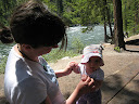
We did touristy things for a bit and then hung out by the Wenatchee River where she got her feet wet and played in the sand. We had dinner in town before setting out to our destination of Glacier View Campground in Wenatchee National Forest.

The Glacier View Campground is a great car camping destination if you are going to be kayaking on Lake Wenatchee. However, it is not well suited to our purpose of just parking the van and camping in it. Most sites have a walk in, so many do not have good platforms to park and camp. We did a lap before opting on site 18 where we got ready for the night.

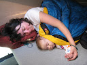
Camping went well and we all slept in the pop top through the night. I had pillow issues which left me with a stiff neck/back the next day, but Mirabelle appeared refreshed when we awoke the next morning. We intended to hike up to Hidden Lake, but typical of mid summer in the Cascades, the mosquitoes were biting. Since we didn't wish to bundle her up too much, and we wouldn't dream of putting deet on Mirabelle, we turned back and figured we could find a less biting option near Leavenworth.

Mirabelle fell asleep in the car ride and we drove up Icicle Creek hoping for a place to hike. When she awoke we tried to hike up the Snow Creek Trail a bit, but that proved too sunny, even with her hat and sunglasses. We once again went back into town to Riverfront Park. We hiked a bit there before stopping at the same locale on the river to have her play in the sand and eddy.

Overall I think this trip went well. We'll perhaps try our first tent outing this summer as well. We may also return to Leavenworth in the autumn when the sun is not so strong but it is drier than the west side. When we got home MIrabelle was a little flush and we thought she had gotten a sun burn. It dissipated, and we were relieved that we were not bad parents.

A Break in the Storm


Light on Cal Poly, originally uploaded by ParsecTraveller.

Storms pounded California all last week, and the wild weather made for wild photography conditions. In a break between storms, the Sun kept poking through the clouds over San Luis Obispo. I got this photo after 80-mph winds blew over my camera and nearly smashed the lens...thank goodness for lens caps!

How's the weather in your part of the country?

Wednesday, October 14, 2009

Just One More Iris Photograph


I promise, this will be the last Iris picture posted this year! It's such an unusual color, least one I've never seen before. These are hybrids that we bought a couple of years ago that I brought with me when the house was sold. They didn't bloom last year but according to my mother that's normal as they don't usually bloom the year they are planted. This is the only one that is this color, all the others are the light blue/pale purple color.

Saturday, October 10, 2009

Mule Deer


We went to Jemez Mountains about a week ago and saw 3 mule deer. You can tell they are mule deer due to the size of their ears. This one was really close and I got a decent photo of her. I was suprised it came out this good as it was almost dark when I took it.

Friday, October 9, 2009

Middle Falls Trail overlooks


Yesterday I posted a picture of Middle Falls in Grand Portage State Park and mentioned the ridge-top overlooks that are along the trail. The photo aboveis taken from the part of the ridge that overlooks Lake Superior. Out in the lake on the left side of the photo you can see a portion of the Susie Islands archipelago, on the right edge of the photo is Hat Point. In between lies Wauswaugoning Bay and Francis Island. It sure is a beautiful view and is certainly worth the hike up the ridge!


After taking in the view of Lake Superior, you can continue to the back side of the ridge for a view of the Pigeon River Valley (above photo). This view, in my opinion, is just as impressive and enjoyable to take in as the view toward the lake. Near the middle of the photo you can see the river as it makes its way toward Lake Superior. High Falls of the Pigeon River is just out of sight on the right edge of this photo. Remember, the Pigeon River is the border between the U.S. and Canada, so all of the land across the river from this viewpoint is in the province of Ontario, Canada! You can also see a glimpse of Lake Superior to the right. FYI - this trail makes for a wonderful fall color hike :-)

Tuesday, October 6, 2009

Oxendon and Kelmarsh tunnels


The two tunnels on Brampton Valley way. Oxendon tunnel 418metres long and Kelmarsh tunnel 480metres long. Both have air shafts that give a circle of light on the ground. Walking through them is a very earie feeling and very dark inside...

Sunday, October 4, 2009

The break-up begins


Just got in from shooting tonight's sunset and after a warm day with bright sun the shoreline ice is really starting to break up in some areas. These chunks of ice were rolling around on the rocks as they were being pummeled by the waves. As each day gets longer and the sun gets higher, it's only a matter of time before this is gone for the year.

Friday, October 2, 2009

Prospect Park and Kensington


Canada goose step


About 5 miles in all. Fine, with a sharp cold wind, and later sunnier and warmer.


American robin


these leaves look as though they've dried in position


A few blocks away from the park - quite unlike most of Brooklyn


tree character 1


tree character 2

Thursday, October 1, 2009

Mirabelle's second camping trip ..

In a stroke of luck, Jennifer and I were both not working. So we took Mirabelle on another camping trip. This time, like the previous out to the warmer, sunnier side of the mountains.


We drove out Wednesday morning and did pretty good timing the drive with Mirabelle's nap schedule. We opted to check out the Aplets and Cotlets (Liberty Orchards) store in Cashmere as our first stop on the warm side. It wasn't really that interesting. And after a few samples, we continued east to the Mission Ridge ski area for a short hike. Unfortunately, this was not well timed with naps, and Mirabelle was a bit over tired when we placed her into the new back pack for the hike. She whined most of the twenty minutes or so we went uphill, and then we took her out for a snack and to see if she would calm down.


No luck with the calming, and we headed back down the hill where she fell asleep moments before returning to the car. Since it was chilly, we just headed back to Leavenworth after a stop at a market on Highway 2.


After playing in town a bit, we headed to Eight Mile Campground for the night. Where we ate dinner, and then had a good night's sleep before being waken up by the camp host. We drove into town and hiked the Nordic trails at the ski area before leaving to come back home. One stop up at Stevens Pass for Mirabelle to stretch her legs, and we were in the final leg of our journey.


North Face of North Twin


North Twin Photo Copyright, John Scurlock, Photographer


One of my favorite stories of all time about Canadian alpinism.


Barry Blanchard and Dave Cheesmond on N Twin in 1985.


http://www.barryblanchard.ca/northtwin


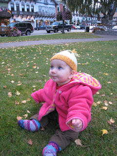
Photo copy right to Barry Blanchard.