Tuesday, August 30, 2011

Mt. Baker, ColemanDeming


Our season opener was a ski/snowshoe climb of Mt. Baker. Snow blocked the road about 2 miles from the trailhead. Doug, Dan, Pete, Jim and Mark about to hit the trail.


The weather was warm and the snow was soft. Jim, Pete and Dan snowshoeing and skinning up to camp.


Mark skinning up the ski approach.


Our camp at 6,100'. Mt. Baker in the background.


Jim above Colfax Peak and Pumice Ridge.


Mark climbing the final 1,000'


Jim on the summit.


Doug on the summit


Mark about to ski from the summit to the road


Huge blocks of ice calving off of Colfax Peak


Jim almost back to the trailhead.

Now it's time to plan our next climb!

Monday, August 29, 2011

Honeymoon Trail, Northeast Minnesota


The colors are fantastic right now! Better get out there and enjoy them while they last!

Sunday, August 28, 2011

Update from Salt Lake City

Well, I've been here a week now and thought I'd better post “something” so y'all would know I'm still alive! The days have been full (and fulfilling) and they have gone by quickly. Time flies whether you're having fun or not but seems to go by much quicker when you are enjoying what you are doing!


There haven't been any “breakthroughs” thus far but then I've been doing the “drudge” work, so to speak – gathering information from Deed Books. Yes, I'm digging into deeds once again. I've done some work in deeds “on location” in several counties in several states but it is so much easier and convenient to work on them here. Even though they don't have “everything” they do have much of what I need to look at. Of course, there are “a few” other things that I'll be working on as well.


And now, something to ponder...


The signatures above are for Charles Wiseman (my 2nd great grandfather) as found in Kosciusko County, Indiana Deed Book 57 pages 128 and 129 and recorded on February 27, 1885 (FHL Film 1705383). It is fairly obvious that the signatures are not the same. In fact, the two entries in the deed book are in a different handwriting (see below).


Also, Charles Wiseman resided in Switzerland County (in southern Indiana) when these deeds were executed. Thus, it is my conclusion that neither one of these is the actual signature of Charles Wiseman! Rather they are the interpretation of his signature that appeared on the documents that were sent to the Recorder's Office in Kosciusko County (in northern Indiana).


In other words, the signature is a transcription. So what this does for me is raise suspicions in regards to other “signatures” recorded in Deed Books or other types of records, such as this one for Wilhelm Foster. It's really kind of a bummer when you thought you might have the actual signature of an ancestor...


Kosciusko County, Indiana Deed Book 57 page 128 (FHL Film 1705383).Note that the writing is different in the two entries.

Friday, August 19, 2011

Ultraviolet 25 Coolum Cave Queensland Australia

Big long moves to good holds and exposure to burn. Nothing too technical, just keep hanging on untill the top.


Photo: Phil Box

Tuesday, August 16, 2011

Blue Ice again?


I have been lucky enough to secure a steady flow of Blue Ice climbing gear to the NA market.


They offer someunique items now and more to come in the near future.


More here:

http://coldthistletools.blogspot.com//04/blue-ice-gear.html

Saturday, August 13, 2011

Hollow

We were at the Homestead Hollow Spring Festival over the weekend. Sold a bunch of soap, ate too much, heard some good music, scoped out everyone else's cameras, and met several blog readers. Thanks for coming by!


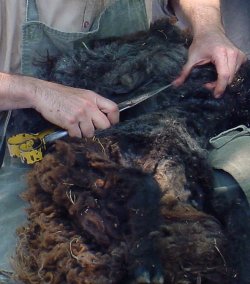
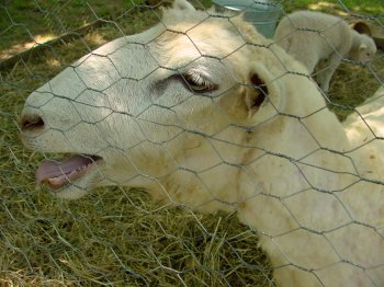
There's a sheep under there somewhere.

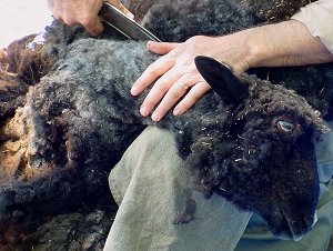
One of my favorite parts of Homestead is watching the Burrells' demonstrations. I forgot my camera and thought I'd missed the sheep shearing, but they did another one on Sunday.


The proverbial black sheep, Malachi.


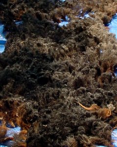
Fleeced!


The previous days' work.


She was clearly trying to tell me something, I just don't know what.


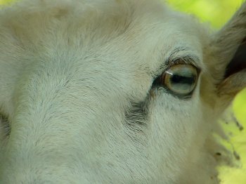
Their eyes are fascinating.


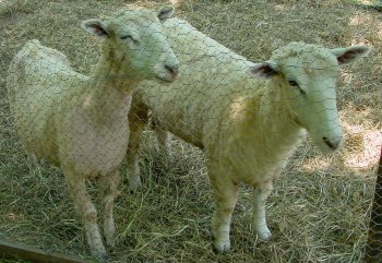
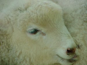
The uncorrupted offspring of the ewes and rams.*


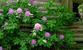
Nothing to do with sheep, I just loved this rhododendron.

*Every time I saw the lamb it reminded me of this line from a John Wesley Harding song.

Christmas Star


Friday, August 12, 2011

Esmerelda ..

I got to go out with Steve for what seemed like the first time this year. (I wanted to say Summer, but it is no longer, and I doubt I have been in the mountains with Steve since Spring.)

Due to my long hard day the previous day, and Steve bringing his wife's cousin along, we opted for a fairly mellow scramble of Esmerelda Peak in the Teanaway.

To avoid traffic we started a touch late, and arrived at the De Roux camp trail head after 9:30am. We hiked up the trail and took frequent breaks. After consulting the map we ignored the turn off point thinking it was just a cut off a switch back. We went too far and arrived at Gallagher Head Lake. We hung out a bit on some wooden benches taking in the scenery and getting cold. We altered our approach and headed cross country to the ridge to climb.

With some light bushwhacking we were on rocky slopes picking our way up the mostly solid terrain. With a few sections of third class rock, we were on the summit, taking in the views. We hung out for a while and then headed to the next "summit" on the ridge to the east. We continued to the next and then developed our plan to hike down a different way. A few loose third class bits got us down the ridge where we followed game trails down most of the way back to the trail. The slope was steep and loose and only got easier as we descended. I saw a fat garter snake on the way down and then we hit the trail and hiked out.

Scrambling the second summit (photo by Steve Machuga)

This was a fun trip and a good trip to do after the bruiser I had the previous day. It was fun to be out with Steve, and the summit of Esmerelda offers pretty nice views in all directions. It took almost as long to do the round trip drive as it did to climb the peak. Steve and I discussed how the book listed it as a T3, but we found it to be fairly easy with only a few steps of 3rd class. However, I am beginning to think that the technical scramble rating used also increases for navigational difficulty. But who knows. Yet another nice day out in the mountains.

My pics are here.

Long Island Sunset


As its name implies, Long Island is a very LONG but narrow island in the Susie Islands. Only about 100 feet wide at its widest point, it is roughly one half-mile in length. This photo was taken at sunset over the East end of Long Island.

Thursday, August 11, 2011

Early autumn at High Falls


I made this image a couple of days ago on the Pigeon River at Grand Portage State Park. Normally I don't care for HDR (High Dynamic Range) photopraphy but in this instance I decided to try HDR, since my split grad filter just wasn't giving me very good results. The image you see here is a blending of 3 different photos at 3 different exposure settings, one exposed for the brightly-lit trees, one exposed for the dark foreground rocks and another one exposed for the middle areas of the scene.

Wednesday, August 10, 2011

Battle at Little Bighorn

Sunday, August 28th - - 135 years ago, late in the afternoon of Sunday June 25th, a battle took place here that has been mired in controversy ever since. It was in this area that 210 men in five companies of the Seventh U.S. Cavalry were killed in action by Lakota (Sioux), Cheyenne, and Arapaho warriors.


“Custer's Last Stand” took place on this hillside where 42 of those 210 men, including George Armstrong Custer, lost their lives. There was supposed to be a three-prong attack but the other two columns of soldiers were delayed. In other skirmishes in the area that day and the next, an additional 58 soldiers and Indian Scouts were killed. It was called the Battle of Little Bighorn by the United States and Battle of the Greasy Grass by the Lakota (Sioux), Northern Cheyenne and Arapaho people.


Custer vastly underestimated the size of the Indian encampment in the valley below; it numbered in the thousands though not all were warriors, there were many women and children as well as older men. (Figures I've seen at various websites put the number anywhere between 6,000 and 12,000 Native Americans camped in the valley.) Thinking that his troops had been discovered, Custer felt that the element of surprise had been lost and that the Indians would quickly leave their camps. So he attacked, splitting his troops in an attempt to surround the encampment. Obviously, that didn't work!


In about a five mile stretch, along the ridges and in the gulleys, the spots where soldiers and some of the Indian Warriors were killed are identified with markers, although in most cases, not with specific names.


Many of the soldiers and the Indian Scouts were mutilated and scalped. However, Custer was not. Some say it was because he was dressed in buckskins rather than a uniform; he had been shot in the temple and in the left chest.


At the top of the hill where Custer made his “last stand” is the memorial to the soldiers and Indian Scouts who lost their lives during the two days of fighting. Their names are inscribed on the sides of the monument.


It is estimated that about 60 Indian Warriors were killed in the fighting. The spots where 14 of them were killed have been identified with reddish-brown markers. These two are for Cheyenne Warriors “Hahpehe'Onahe” aka Closed Hand and “A'Kavehe'Onahe” aka Limber Bones who “fell here on June 25, 1876 while defending the Cheyenne way of life”.


The Battlefield is dotted with interpretive signs that help in understanding what took place and when. This sign is across the road from the memorial to the fallen soldiers. The visitor center also has a 17-minute video and park Rangers give a 20-minute talk every half hour or so. The video and talks are quite interesting.


Across the road and a short distance from the memorial to the soldiers, is the Indian memorial, which was authorized in 1991 along with a law that changed the name from Custer Battlefield National Monument to Little Bighorn Battlefield National Monument. A large circular area contains the above sculpture as well as a wall of displays embedded in black granite. It was quite impressive and very informative, presenting just a little bit of the battle from the perspective of the Native Americans.


A detail of the sculpture.


Some of the Indian Scouts in the employ of the U.S. Army and with the 7th Cavalry were members of the Crow nation. The Crow considered the Lakota, Cheyenne, and Arapaho people to be their enemies because, among other things, the Sioux tribes were encroaching on what had traditionally been Crow territory.


The panel above depicts the scene of the Battle of The Greasy Grass as drawn by White Bird of the Northern Cheyenne.


On August 10, 1983 a prairie fire swept over the battlefield, burning nearly 600 acres of dense, thick vegetation. For five weeks in May and June of 1984 the National Park Service conducted a systematic archeological survey of the battlefield. They recovered 1,159 artifacts including arrow heads, bullets, cartridges, buttons, coins, soldier skeletal remains, boots, military and horse equipment, and personal items of soldiers and warriors. Archeological evidence, used in conjunction with accounts of the battle participants and placement of soldier bodies help in reconstructing the battle. Additional archeological surveys were conducted in later years and will continue in the future.


A four mile drive along the ridges of the battlefield provides some idea of the extent of the battle and the challenges wrought by the terrain.


The markers for an Interpreter Guide “Neesirapat” aka Bloody Knife and two Indian Scouts “Hukos-ta-rikus” aka Sgt Bobtail Bull and “Naahukoos Ciripaslt” aka Little Brave who fell here “while defending the Arikara way of life”.


Much has been written about the Battle of Little Bighorn with various interpretations of the events leading up to the battle and of what actually occurred during the battle – just do a search for it and I'm sure you'll come up with quite a variety of websites! It seems that History is always open to new interpretations, so regardless of your own feelings and ideas of what happened here I'm also sure you will learn something new - I know I did!


Happy Birthday Uncle Bill


Tuesday, August 9, 2011

Inconceivable!


I told people that I'd spent most of last week sticking my head out the window, yelling, "Inconceivable!" Storm after storm passed by, edging just to the north or just to the south.

How this line missed us, I have no idea. Storms here generally march from left to right, or rather, west to east. We are in the area outlined by the white box, yet once again, we didn't get a drop of rain. Inconceivable!

Sunday, August 7, 2011

Wordless Wednesday :: Icelandic Church

Near Keflavik, Iceland. Summer of 1973.Copyright © 1973/.. by Rebeckah R. Wiseman

Saturday, August 6, 2011

and a 5 and a 6


What would life be with out more critters to take care of. As if we didn't have enough horses we let ourselves be suckered in to taking 2 more horses last July. Acutually they are ponies. Well sort of. Number 5 is Stormy who is half Minuture Horse and half Shetland, number 6 is Traveler who is half Tennessee Walking Horse and half Shetland. They are half brothers on their Shetland mama side. You wouldn't know it to look at them. Stormy is the short solid black one and Travey is the larger pinto. At this time they are still stallions and I am not sure when or if we will geld them. Right now they don't seem to know they are stallions but I am sure that will change when the mares start coming in season soon. Right now all they want to do is play. And play they do. They are constantly running, bucking, kicking, and biting on each other. They need the excersise and it runs them down as it would little kids on the playground. I have hopes someday of a cart and harrness but that might be another dream. Travey is terrified of any kind of rope around his rear end. Stormy does ok and both are good at leading, grooming, and tying now. You can see the difference in their size in the photo and I hope Travey doesn't get so big I have to seperate them. He does seem to be getting taller, remember he is half Tennessee Walker, and is not quite 2 years old yet. Stormy is almost 3.

Tuesday, August 2, 2011

Encased in Ice

What a difference a day makes!

Yesterday was a sunny, bright, beautiful day.

Today is dull and gray. And everything outside is encased in a layer of ice.

But if we have to have dull, gray, icy days, better today than yesterday! Because yesterday I had to take my mom to the doctor for a follow-up exam. That meant a 30 minute drive to Columbia City to pick her up then a 45 minute drive to Auburn. Fifteen minutes waiting to see the doctor, about ten minutes spent with him in the office, and then reverse the drive back home. I'm so glad yesterday was a nice day! And so very glad that I don't have to go out in this mess today!!

The view from my front door. Doesn't look too bad? Well, there is about three inches of compacted slush, snow, ice and sleet in the drive. I haven't ventured out to the mail box yet. No traction. The pictures were all taken within 20 feet of the apartment and I used the flash to get some definition and contrast.

Looking closely at the trees, shrubs and weeds you'll see there is about a ¼ to a ½ inch of ice covering everything. Not nearly as bad here as it is in Columbia City or South Whitley (where my niece lives and is currently without electricity) or further south. And not even close to what struck the northeast coast last week or the northwest this week. So we are very fortunate here. Most of the schools in the area closed for the day giving the kids an extra day for their winter break.