Monday, October 28, 2013

Norrøna Lyngen down jacket?


First time I have done something like this. But the priceis a$100 off what I paid for mine a couple of years ago. While notcheap itis an exceptionaljacket. Normal retail is 349 Euro or $465 today! I get nothing from this. Just a friendlyheads up to the localsthat might be interested. B/C has 47 in stock and three color choices @ $279.16 delivered. Gotta love a strong dollar.


http://www.backcountry.com/norrna-lyngen-down-jacket-mens


http://www.norrona.com/Products/3172-09/lyngen-down750-jacket-w


http://coldthistle.blogspot.com//03/design-triumphsthe-norrna-lyngen-down.html


NORRØNA (V) MAGAZINE - A ski oddysey from Norrøna on Vimeo.

Temperature Regulation and Underlayers

Ibex, Icebreaker Wool Underlayers

From a reader's email, quoted with permission:

...not sure how to put this delicately, but when I ride my bike in the cold I inevitably end up with a sweaty bra. Even if I am not exerting myself, the bra is soaking wet by the time I get to work and The Girls are not happy spending an entire morning waiting for it to dry. I've taken to stuffing paper towels in there, but was hoping you could share a better solution. How do you deal with this? Don't tell me you only wear wool bras?


Now approaching my third winter of cycling, one of the most valuable lessons I've learned is how to dress for the cold weather. Merely piling on layers can lead to overheating, then freezing underneath the sweat-soaked clothing when stopped at red lights. This is where choice of fabric becomes important. Wool and silk not only keep me warm, but regulate my body temperature - meaning that I sweat lessunderneath all those layers of warmth than I do wearing cotton or synthetic fabrics. And compared to technical synthetics, wool and silk do not retain body odor.


When choosing temperature-regulating fabrics, the key to the whole system working for me is to start from the inside out. If I am wearing a wool sweater with a cotton long-sleeve tee underneath, that cotton is going to be drenched in sweat; it's better to wear a wool baselayer and a non-wool garment on top of that. Similarly, underwear matters a great deal, since it is the first thing to contact the skin. Cotton or polyester underwear will end up soaked in sweat, causing discomfort even if every single other article of clothing I am wearing is wool.


So yes: In response to the reader's question, I only wear bras made out of fabric that regulates my body temperature effectively, which for me means wool or silk. Wool is the more durable and somewhat more effective option. But wool bras tend to be plain and sporty looking, and not everyone likes that. Also, women with larger chests often report that these bras do not offer sufficient support. If you prefer a look and feel that is more lingiree than sportsbra, real silk bras are available with everything from decorative lace to underwire support and nylon stretch. After having tried a number of manufacturers, I have settled on Ibexfor wool underwear,and onWinter Silksfor some fairly inexpensive silk bras. I also like to wear Icebreakerleggings instead of stockings once it gets cold, and always Smartwoolsocks. There are other excellent options out there. But as long as it's wool or silk, there should be no need to stuff your bra with paper towels before cycling to work.

Life's a ditch


There is a ditch in here somewhere.

But it's clogged with trees, sediment, and years of the neighbors' trash, so when it rains heavily our driveway washes out.


The previous tenants told us that the county worked the road for them, but in our moment of need it was pronounced a private road. All my "but the water is coming from your county road" reasoning did not prevail.


This was the other problem. A storm had washed some debris and huge dead trees to rest against some very large culverts. It did not enter our minds that industrious beavers would see this as a gift, and make the situation even worse.

But they did, and the neighbor's property began to flood. (It was putting some of my favorite wildflowers underwater too!)


Ahh.


Ahhhhhh. I feel better now.

When backhoe work starts at $70 an hour, it's easy to believe that time is money.

"He's been here $140 and it seems like he's just started," I fretted.

I was gone running errands for $210.

"My husband will be home in about $175," I realized at one point.

Actually we feel lucky to have had both problems fixed in just under ten hours. It could have been a lot worse.

Sunday, October 27, 2013

A Year in Cadence


Some time ago I discovered the concept of cadence. Put simply, cadence is the rate at which the cyclist is pedaling, measured in crank revolutions per minute (rpm). People I ride with will sometimes tell me mine is high, which is how I became curious what it is. For a while I had a computer with a cadence sensor and was able to monitor it. When I first got the sensor it was typically in the mid-80s. Eventually it grew into the low 90s. Then last Spring I got my new bike, and it came with a new-fangled fancy computer, but no cadence sensor. I meant to add it, but then forgot. A year went by during which I had no idea what my cadence was. Then last week, again I got a comment from someone riding next to me. It was something like "Jeez you pedal like you're going downhill on a fixed gear! Might as well take off that big ring, eh? Looks hardly used!" (this is true). At the same time,this postappeared on Heidi Swift's site, glamourising riding in the small ring à la Julie Krasniak. So I figured the universe was trying to tell me something.


I asked at my cycling club (which is also a bike shop, which is also a cafe) about installing a monitor. "Oh it's easy!" they said, and swiftly attached an enormous ugly thing to my bike's left chainstay. The sheer size and alienness of it took me aback, since my previous cadence monitor had been just a wisp of a thing. Eying the monstrous appendage apprehensively, I got on my bike and pedaled away.


Getting up to Just Riding Along pace, I glanced at the cadence and saw that the number was 103. I thought no, that's not right. And with all that thinking going on, it did drop a bit - but then promptly rose again. I rode a loop on rolling hills, glancing at the cadence occasionally. Mid 90s - low 100s seems to be a range I am comfortable with, without getting out of breath.


Curious, I decided to check how high I could make that number go up. Seeing 112 was pretty fun, rising toward 120! I kept that up for a bit, until suddenly I was overwhelmingly nauseous. I will have to experiment more carefully...


I'm not sure what to make of my rising cadence numbers over the years. I guess I just plain like to pedal fast and feel little resistance. Alas, I don't seem to ride any faster or more elegantly because of it. But it's fun to see the number go up. And it certainly explains why I like having low gears on my bikes!

The Cliffs of Shore Acres


On this blustery winter's day with snow falling from the sky I find my thoughts wandering back to our mid-November trip to the Oregon coast and the beautiful weather that we encountered. Yes, it did rain as it so often does on the Oregon coast this time of year. But, we did also have some beautiful weather, as shown here at Shore Acres State Park near Coos Bay. Shore Acres is known for the massive ocean waves that frequently hammer the cliffs shown in this photo. On the day we visited, however, the ocean was about as calm as it gets. We would have loved to hang around into the evening to experience the amazing christmas light display that the park is also known for, but unfortunately we were a little too early in the season for that.

Saturday, October 26, 2013

Friday, October 25, 2013

South Early Winter Spire SW Rib ..

Elevation Gain: 2600'
5 miles RT
Left car: 11:15 am
Summit: 7:30 pm
Back at car: 10:00 pm
11 hours car to car

Steve and I planned a big climbing weekend. We didn't finalize our objectives until a few days before the weekend. The first leg would be an attempt on the Southwest Rib of South Early Winter Spire. Our plan was to climb South Early on Saturday, and then head to Cascade Pass to climb Forbidden on Sunday/Monday.

We had a casual start from Seattle on Saturday and arrived at the Blue Lake trail head in the late morning. Temps were cool, and it was a bit cloudy. We made awesome time to the base where we ate lunch and started to gear up. (And Steve took a "bathroom break".) There was a party on route ahead of us and they were a few pitches up. We hung our remaining gear in the tree, and headed up the direct start. [Using the description from Weekend Rock.]

Steve led off on the first pitch which was a loose and not easily protected corner. He went a little off route at one point (he called it the 5.10 variation) and was finally at the belay. I followed and found the pitch a struggle, and mostly unenjoyable. The off route variation took me some time to complete as I couldn't manage the moves Steve did and did an even different variation. This off route issue on the first pitch burned a lot of time for us, (Steve thought over and hour) but we weren't too concerned.

I led off on the next pitch which was short and if we didn't go off route on the first pitch, probably could have been combined with it. This short pitch was a moderate crack that brought you up to the next belay just below a major flake that is the following pitch. We changed over leads and Steve was on his way.

This crack is wider and has an interesting design to it with a large edge as its left side. The crack was fairly steep, and Steve headed up it straddling the flake with one leg on the face and one in the crack. There was much grunting. (Not as much as from the woman who was ahead of us-I think she was actually crying at one point.) Steve made his way up and commented about the amount of blood on the rock. He combined the pitch with the following pitch and started to bring me up. I climbed the crack with both feet in for the initial part, and then about 1/3 of the way up I used the flake for feet as my feet were killing me from jamming them in the crack. The last third of the pitch you come out and lie back the final portion. Exciting to go from the relative security of the crack out on to the face. The second pitch of this link up was a wide crack in a slab.

Top of the fourth pitch (photo by Steve Machuga)

It was my turn to lead the next pitch which was a slab pitch. It starts out by going around a corner and then up a nice slab with some exposure. The book description said somewhat runout, but it was oddly only runout for the crux, which in the book was stated as being "an exciting step to the right." It was a fun pitch and I set a gear belay at the base of the bear hug cracks and brought Steve up.

Rounding the corner to gain the slab (photo by Steve Machuga)

Since I had told Steve at the base that I wanted to lead the bear hug cracks, he let me lead this next pitch as well. This was a super enjoyable pitch where you head up a short crack that brings you to a small ledge at the bottom of wide double cracks. They took a touch of effort to get on, but once on them, I found the climbing easy. What was not particularly easy was protecting them. We had brought a #5 Camalot just for this pitch (although we used it on 2-3 other pitches as well.) The bear hug cracks were too wide for the #4 and so I had to move the #5 up with me at least once. Just above the cracks I was able to get in a #4 and then proceeded up a ramp to the next belay, where I brought Steve up.

Bear Hug Cracks (Photo by Steve Machuga)

Steve led out on the next bit and then we started simul-climbing. (This was roughly pitches seven and eight.) He belayed me up to just below the bunny ears, and then I led a short bit to the rap anchor at the bunny ears. We rapped off the scary (freestanding block) anchor into the notch. Then Steve led the final pitch up to the summit area. It was a fun little crack that brought you up to near the summit. Since it was late in the day and clouds seemed to be rolling in, we bypassed the summit block and started our way down the South Arete.

Bottom of pitch 7 (photo by Steve Machuga)

We scrambled most of the the descent until we got to one of the chimneys. We opted to rappel at the rap station there and that is where we were joined by another party who had just topped out on an east face route. One of the guys, Blake, scrambled down to me and set up the next rappel at the next chimney and rapped down. They allowed us to use their rope and I rapped it to find Blake scrambling down to the base. One of his partners came down and said "its only 5.0 right?" and started scrambling the final bit as well. His other partner showed up with another rope and we rappelled to the base. The one partner who started scrambling got a bit sketched and rapped the last bit before Steve could finally rap down.

Once on the ground, we returned to our packs at the base, turned on our headlamps and hiked out.

Overall this was a great climb. Although it was 5.6, the first pitch was no doubt the crux for us. (Were we off route the entire time?) It was loose, not well protected, and strenuous. There were three really enjoyable (dare I say great?) pitches on the route and some other good pitches as well. While clouds threatened all day, they mostly stuck to bothering the nearby peaks like Silver Star and Cutthroat. It was windy and cool on route, but we did have brief moments of sun.

My pics are here.

Tuesday, October 22, 2013

North and South Fowl Lakes


For quite a while now I've known about a road that goes to a boat access on North Fowl Lake on the Canadian side of the lake, but never knew just how to get there. Yesterday I spent the afternoon in Thunder Bay and on my way home I took some time to drive the logging roads and try to find the route to North Fowl Lake. It was actually fairly easy to find (of course, I had a GPS with me so I knew how far away from the river I was. This made it easier to find the route, even though the GPS didn't show any of the roads that I was on). I arrived at the North Fowl shoreline just in time to make the sunset image seen above. As I watched the sun go down I could hear several loons calling from across the lake. Loons are always a treat to hear, but their call is so much more magical when accompanied by a beautiful sunset.


(Above: The sand spit that separates North Fowl from South Fowl)

Now that I knew how to access these two lakes by road, I couldn't wait to get my kayak out on them. So, the next day I crossed the border back into Canada with my kayak and headed back to the boat landing on North Fowl. I spent the whole afternoon and early evening paddling on the lakes, wandering my way around, exploring the shoreline and the many wild rice beds that occupy the lakes. By the time I made it back to the landing I had been on the lakes for about 5 hours and covered over 10 miles. It sure was a great day!


(Above: Launching into the surf on South Fowl Lake)


(Above: "Goose Rock", South Fowl Lake)


(Above and below: I recently purchased a Canon G10 camera and an Aquapac underwater bag for it, with the intention of using it as my primary camera when I am out in the kayak. I also have several ideas for underwater images... one of them being the image below, which is an underwater view of wild rice on North Fowl Lake)

Thursday, October 17, 2013

The Desert

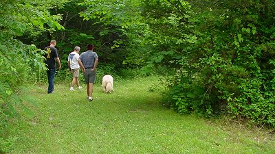
This is out on the desert near where I sometimes ride. On this day I walking my Border Collie Tuffee. You can see the Sandia Mountains in the distance. Albuquerque is hiden between us and the mountains down along the Rio Grande valley.

An Illinois Round Barn

Tuesday, May 3rd - - As I left Argyle State Park this morning, I turned right instead of left thinking that the road would loop around back to US 136. It didn't. But I came across this neat old Round Barn. I would have loved to take a look inside but it was some distance from the road and it was on private property. As you can see, blue skies and sunshine were in abundance! It was a cool 41 degrees but there was no wind so it was actually rather comfortable.


Tuesday, October 8, 2013

Sunday stroll

I had to be pushed into walking during the heat of the day. It was cloudy but very muggy.


They usually get irritated with me anyway, because I'm always stopping to take pictures


of important things like wild petunias (Ruellia sp.)


and Silvery Checkerspot (Chlosyne nycteis) butterflies.


And besides, none of them understand how exciting it is to find a Pawpaw tree (Asimina triloba).

Plate Ice Mosaic


As you may already know from the photo I posted last night, the sunset yesterday was nothing short of mind-blowing. The ice formations combined with the awesome clouds and colors in the sky made for a scene that I will never forget. After making several wide-angle images of the scene, I switched to my 100-400mm lens and made a few abstract images by isolating different areas of the ice. This area that you see here was different from the rest. Most of the ice was jutting up at all different angles, but in this area the ice was all laying more or less flat. Each piece was reflecting a bit of the sky. It was one of the coolest things I've ever seen in all my life of living along the shores of Lake Superior.

Monday, October 7, 2013

Iron Goat Trail ..

Hot weather and mixed signals caused me to be sans partner again. Originally I was pretty bummed, but really enjoyed my final choice of destination or, conveyance.

I looked through a mountain bike guide and decided to get some low impact exercise. I decided on the Iron Goat Trail as it is in the south side of the valley and should be fairly shady. It is a rail trail and used to be part of the Milwaukee Railroad. It is also part of the larger John Wayne Pioneer Trail, which stretches most of the way across the main portion of the state to Idaho. I was also excited to ride my bike through the Snoqualmie Tunnel. However, since this was a plan hatched before going to bed the night before, I had no idea the tunnel was closed.

The tunnel
I parked for the trail off Exit 38 of I-90, but could have taken the western terminus near Rattlesnake Lake. This is where I saw the sign in the parking lot stating the tunnel was closed. Mostly it meant I did not have to worry about a headlamp, and it was cutting about five miles round trip off my excursion.

Since it was unclear where to access the trail, I accidentally rode up the pedestrian foot trail before locating the rail trail and heading east. I immediately starting riding by the Exit 38 crags where people were climbing (and blocking the trail.) The route is deceptively flat/uphill. It has to do with the maximum angle a trail can climb, which isn't that steep. The trail looks flat, but I had to constantly grind my way uphill. A much different workout than a steep hill where you can alternate between standing and sitting. My speed was twice as fast, and cadence maybe five times faster. Sections with deeper gravel really took extra effort. I paused at the halfway uphill point to catch my breath a bit. It was also nice not to be sitting, as my mountain bike saddle is not meant for thirty miles of continuous sitting.

I rode along occasionally standing to give my backside a rest while passing hikers and other bikers. I also passed numerous trail heads that I have been to before while hiking or climbing. In a little over an hour, I reached the closed tunnel. A few pics were snapped, I snacked a bit, and then it was time to enjoy the downhill. There is a nice picnic area there that offers views of Snoqualmie Pass peaks.

The Tooth, Denny, Snoqualmie Peaks

While I did not have to continuously pedal for the downhill, it was not steep enough to coast the 14 miles. Of course, to make things more difficult there was a headwind in many locations on the return trip. More wooded areas blocked the wind, but on the trestles, it slowed me down a touch. I was back at the car over two hours after I left.

This was a good ride and fairly mellow if you discount the fact that it is uphill the whole way east. Hopefully the state will find the money to make the tunnels safe so one could ride to Idaho if they wanted. The fourteen mile section I was on had some ample camp sites, although I'd imagine I wouldn't need one until the other side of the pass.

Wednesday, October 2, 2013

Another view on alpine clothing?


"Getting the right alpine winter clothing system is a nightmare of trial, effort ... and money, because you go through just about every kind of environment. First you have a walk or ski in, often conducted in sunshine, which makes things incredibly hot. Then you gear up at the base in the shade feeling a little cold and clammy, and follow this with some simul climbing up a big snow couloir to reach the base of the difficulties, where you'll start either getting cold on a belay or want to shed as much clothing as possible to increase your mobility when leading the pitch."


More here:


http://www.ukclimbing.com/gear/review.php?id=3533


and here:


http://www.alpineexposures.com/blogs/chamonix-conditions/3369432-alaska--photos-west-buttress-denali-and-the-cassin-ridge